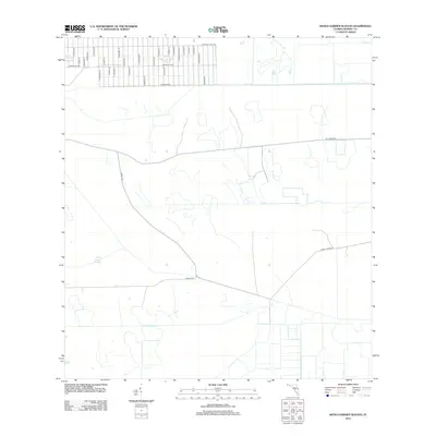
2012 Map of Devils Garden Slough
USGS Topo · Published 2012About this map
Devils Garden Slough defines the hydrologic character of this Hendry County landscape, where wetlands and drainage patterns dictate the placement of human infrastructure. In the northern section, a distinct residential grid emerges, characterized by a dense network of streets with Spanish and equestrian-themed names such as S Hacienda St, S Utopia St, and Appaloosa Ave. This planned development is bounded by Perimeter Rd, transitioning into a more open, rural interior. Beyond the grid, the terrain is navigated by arterial routes like Hunting Club Ave and Dooley Rd, which bridge the gap between the structured settlement to the north and the expansive, watery reaches of the slough to the south. The map illustrates a moment of rural expansion where geometric property lines meet the winding natural boundaries of Florida's inland wetlands.
Find a feature on this map
32 named features on this map. Tap any name to fly to it.
Don’t see what you’re looking for? This feature index may not catch every label — zoom into the map to look around manually.
Map Details
Editions of this 2012 Devils Garden Slough Map
This is the sole edition of this map. No revisions or reprints were ever made.
Other maps of this area

1956 · West Palm Beach
USGS Topo · 1:250,000

1957 · West Palm Beach
USGS Topo · 1:250,000

1958 · West Palm Beach
USGS Topo · 1:250,000

1970 · Lake Harbor SW
USGS Topo · 1:24,000

1970 · Clewiston South
USGS Topo · 1:24,000

1970 · La Belle 4 SE
USGS Topo · 1:24,000

1970 · La Belle 4 NW
USGS Topo · 1:24,000

1970 · La Belle 4 NE
USGS Topo · 1:24,000

1971 · La Belle 4 SW
USGS Topo · 1:24,000

1974 · Immokalee 1 NE
USGS Topo · 1:24,000