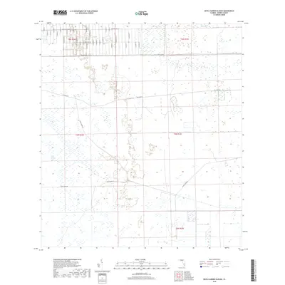
2018 Map of Devils Garden Slough
USGS Topo · Published 2018About this map
Devils Garden Slough and Hog Cypress define the low-lying, wetland-rich interior of Hendry County. This landscape is characterized by a sprawling grid of rural development in the north and large-scale agricultural or drainage corridors in the south. A dense network of residential streets, including S Riverside St, Hunting Club Ave, and S Cabbage Palm St, occupies the upper sections, contrasting with the long, straight maintenance tracks of Hill Grade Rd and Dooley Grade Rd that segment the southern wetlands. The map illustrates a transitional phase of Florida land use where traditional wilderness drainage patterns intersect with organized residential platting. This specific layout provides a clear view of the drainage canals and perimeter markings that manage the regional water flow through the sloughs and cypress stands.
Find a feature on this map
37 named features on this map. Tap any name to fly to it.
Don’t see what you’re looking for? This feature index may not catch every label — zoom into the map to look around manually.
Map Details
Editions of this 2018 Devils Garden Slough Map
This is the sole edition of this map. No revisions or reprints were ever made.
Other maps of this area

1956 · West Palm Beach
USGS Topo · 1:250,000

1957 · West Palm Beach
USGS Topo · 1:250,000

1958 · West Palm Beach
USGS Topo · 1:250,000

1970 · Lake Harbor SW
USGS Topo · 1:24,000

1970 · Clewiston South
USGS Topo · 1:24,000

1970 · La Belle 4 SE
USGS Topo · 1:24,000

1970 · La Belle 4 NW
USGS Topo · 1:24,000

1970 · La Belle 4 NE
USGS Topo · 1:24,000

1971 · La Belle 4 SW
USGS Topo · 1:24,000

1974 · Immokalee 1 NE
USGS Topo · 1:24,000