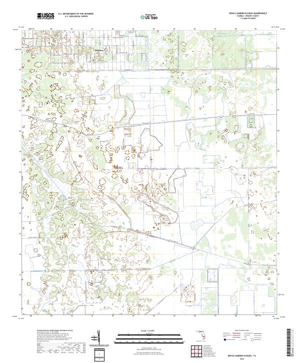
2024 Map of Devils Garden Slough
USGS Topo · Published 2024About this map
Montura stands as the primary residential cluster in this inland section of Hendry County, defined by a distinct grid of Spanish-named streets such as S Palomino St and S Cabbage Palm St. The surrounding landscape is dominated by the namesake Devils Garden Slough, a low-lying drainage pattern typical of the Florida Everglades' western fringe. This map captures a transition from structured residential planning in the north to the hydrologic expanse of Hog Cypress and various managed agricultural or conservation tracts. Large rectangular parcels and thoroughfares like Hunting Club Ave and Appaloosa Ave reveal a land-use pattern where rural development meets the natural wetlands of the southern interior.
Find a feature on this map
42 named features on this map. Tap any name to fly to it.
Don’t see what you’re looking for? This feature index may not catch every label — zoom into the map to look around manually.
Map Details
Editions of this 2024 Devils Garden Slough Map
This is the sole edition of this map. No revisions or reprints were ever made.
Other maps of this area

1956 · West Palm Beach
USGS Topo · 1:250,000

1957 · West Palm Beach
USGS Topo · 1:250,000

1958 · West Palm Beach
USGS Topo · 1:250,000

1970 · Lake Harbor SW
USGS Topo · 1:24,000

1970 · Clewiston South
USGS Topo · 1:24,000

1970 · La Belle 4 SE
USGS Topo · 1:24,000

1970 · La Belle 4 NW
USGS Topo · 1:24,000

1970 · La Belle 4 NE
USGS Topo · 1:24,000

1971 · La Belle 4 SW
USGS Topo · 1:24,000

1974 · Immokalee 1 NE
USGS Topo · 1:24,000