
1931 Map of Devils Lake
USGS Topo · Published 1931About this map
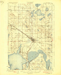
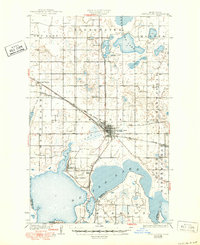
The city of Devils Lake serves as a hub of the prairie landscape in this late 1920s survey, situated at the intersection of the Great Northern and the Minneapolis St Paul and Sault Ste Marie railroads. The topography is defined by its complex glacial hydrology, featuring the expansive waters of Creel Bay and Sixmile Bay, alongside significant bodies like Sweetwater Lake and Dry Lake. To the south, the military and recreational presence at Camp Grafton and the adjacent Rifle Range sits near the resort community of Lakewood (Chautauqua PO). This era of North Dakota history is captured through a dense network of rural infrastructure, including Consolidated School No 1 and various township schoolhouses that supported the farming communities in Freshwater and Morris. The map also records the early state highway system, such as State Highway No 2, which provided vital terrestrial links between settlements like Grand Harbor and the neighboring counties of Ramsey Co and Benson Co.
Find a feature on this map
38 named features on this map. Tap any name to fly to it.
Don’t see what you’re looking for? This feature index may not catch every label — zoom into the map to look around manually.
Map Details
Editions of this 1931 Devils Lake Map
3 editions found
Other maps of this area

1928 · Tokio
USGS Topo · 1:62,500

1930 · Hamar
USGS Topo · 1:62,500

1931 · Oberon
USGS Topo · 1:62,500

1931 · Tokio
USGS Topo · 1:62,500

1932 · Grahams Island
USGS Topo · 1:62,500

1950 · Tokio
USGS Topo · 1:24,000

1950 · Grahams Island
USGS Topo · 1:62,500

1950 · Devils Lake
USGS Topo · 1:62,500

1950 · Oberon
USGS Topo · 1:62,500

1951 · Crow Hill
USGS Topo · 1:24,000