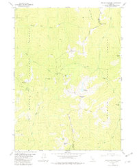
1981 Map of Devils Punchbowl
USGS Topo · Published 1982About this map
Devils Punchbowl sits at the heart of this remote high-country landscape, where the administrative boundaries of Six River National Forest, Siskiyou National Forest, and Klamath National Forest converge. The terrain is defined by the headwaters of several major waterways, including the Siskiyou Fork Smith River and Clear Creek. Human presence is marked by legacy sites such as Prescott Cabin (Ruins) and the seasonal Trout Camp, suggesting a history of backcountry exploration and survival. Small alpine water bodies like Buck Lake, Elk Lake, and Island Lake are scattered across the drainage basins, while the presence of a Prospect near Doe Creek hints at the area's mineral interests. The map documents a complex network of ridges and basins, including Bear Basin and Bear Paw, which long served as natural transit corridors through the Siskiyou Mountains.
Find a feature on this map
28 named features on this map. Tap any name to fly to it.
Don’t see what you’re looking for? This feature index may not catch every label — zoom into the map to look around manually.
Map Details
Editions of this 1981 Devils Punchbowl Map
4 editions found
Other maps of this area

1922 · Preston Peak
USGS Topo · 1:125,000

1945 · Ship Mountain
USGS Topo · 1:62,500

1945 · Gasquet
USGS Topo · 1:62,500

1948 · Weed
USGS Topo · 1:250,000

1950 · Weed
USGS Topo · 1:250,000

1951 · Gasquet
USGS Topo · 1:62,500

1952 · Ship Mountain
USGS Topo · 1:62,500

1955 · Dillon Mtn
USGS Topo · 1:62,500

1956 · Preston Peak
USGS Topo · 1:62,500

1958 · Weed
USGS Topo · 1:250,000