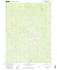
1981 Map of Devils Punchbowl
USGS Topo · Published 1991About this map
The Devils Punchbowl sits at the heart of this high-elevation landscape, where the Six Rivers National Forest and Klamath National Forest meet. This terrain is defined by the headwaters of the Middle Fork Smith River and its various tributaries, including the Siskiyou Fork and South Siskiyou Fork. Evidence of earlier human presence is visible at Prescott Cabin (Ruins) and Trout Camp, while the topography is dominated by prominent peaks such as Bear Mtn, Jedediah Mtn, and the Twin Peaks. The county line between Del Norte and Siskiyou counties cuts across the high ridges, including Siskiyou Pass. Several small alpine water bodies, notably Island Lake and Buck Lake, are tucked into the high basins beneath the ridgelines.
Find a feature on this map
29 named features on this map. Tap any name to fly to it.
Don’t see what you’re looking for? This feature index may not catch every label — zoom into the map to look around manually.
Map Details
Editions of this 1981 Devils Punchbowl Map
4 editions found
Other maps of this area

1922 · Preston Peak
USGS Topo · 1:125,000

1945 · Ship Mountain
USGS Topo · 1:62,500

1945 · Gasquet
USGS Topo · 1:62,500

1948 · Weed
USGS Topo · 1:250,000

1950 · Weed
USGS Topo · 1:250,000

1951 · Gasquet
USGS Topo · 1:62,500

1952 · Ship Mountain
USGS Topo · 1:62,500

1955 · Dillon Mtn
USGS Topo · 1:62,500

1956 · Preston Peak
USGS Topo · 1:62,500

1958 · Weed
USGS Topo · 1:250,000