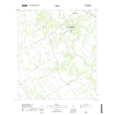
2019 Map of Dewees
USGS Topo · Published 2019About this map
The San Antonio River snakes through the landscape of Wilson County, anchoring a terrain defined by its complex network of creeks and drainage basins. To the north, the outskirts of Floresville sit near the Sacred Heart Cem, while a portion of the San Antonio Missions National Historical Park preserves a critical cultural corridor along the riverbanks. This modern survey illustrates the persistent agricultural and ranching character of the region, evidenced by landmarks like the Circle P Ranch Airport and various localized water catchments such as Connally Lake Dam and Seale Ranch Lake. Downstream, the small settlement of Dewees serves as a junction point for farm-to-market roads, surrounded by named tributaries including Olmos Cr, Sulphur Cr, and Picosa Cr, which continue to shape the rural geography of south-central Texas.
Find a feature on this map
47 named features on this map. Tap any name to fly to it.
Don’t see what you’re looking for? This feature index may not catch every label — zoom into the map to look around manually.
Map Details
Editions of this 2019 Dewees Map
This is the sole edition of this map. No revisions or reprints were ever made.
Other maps of this area

1925 · Tordia No. 1
USGS Topo · 1:48,000

1931 · Falls City
USGS Topo · 1:62,500

1936 · Floresville
USGS Topo · 1:62,500

1953 · Crystal City
USGS Topo · 1:250,000

1954 · San Antonio
USGS Topo · 1:250,000

1955 · Crystal City
USGS Topo · 1:250,000

1956 · Pleasanton
USGS Topo · 1:62,500

1957 · San Antonio
USGS Topo · 1:250,000

1958 · Saspamco
USGS Topo · 1:24,000

1961 · Crystal City
USGS Topo · 1:250,000