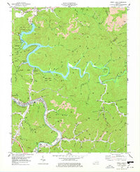
1978 Map of Dewey Lake
USGS Topo · Published 1978About this map
Jenny Wiley State Park dominates this 1970s landscape, where the impounded waters of Johns Lake wind through the narrow valleys of Floyd and Johnson Counties. The topographic record shows a region defined by heavy coal extraction, with numerous strip mines and industrial sites dotting the ridges above Johns Creek. Along the southwestern edge, the city of Prestonsburg serves as a local hub near the Levisa Fork, supported by the Chesapeake and Ohio railroad corridor. Smaller settlements like Lancer, Watergap, and Emma are clustered along the river and rail lines, while numerous family and community landmarks such as Wrights Chapel, Trimble Chapel, and the Endicott Cem provide essential data for genealogical research. The map also highlights recreational developments around the lake, including the Amphitheater and Brandy Keg Boat Dock near the Dewey Dam.
Find a feature on this map
78 named features on this map. Tap any name to fly to it.
Don’t see what you’re looking for? This feature index may not catch every label — zoom into the map to look around manually.
Map Details
Editions of this 1978 Dewey Lake Map
Other maps of this area

1886 · Prestonsburg
USGS Topo · 1:125,000

1892 · Prestonsburg
USGS Topo · 1:125,000

1914 · Laynesville
USGS Topo · 1:48,000

1914 · Inez
USGS Topo · 1:48,000

1915 · Paintsville
USGS Topo · 1:48,000

1915 · Prestonsburg
USGS Topo · 1:62,500

1916 · Harold
USGS Topo · 1:62,500

1916 · Inez
USGS Topo · 1:62,500

1917 · Paintsville
USGS Topo · 1:62,500

1918 · Prestonsburg
USGS Topo · 1:62,500