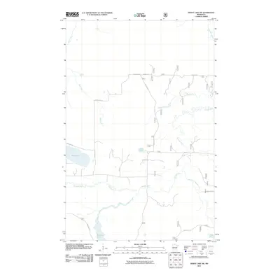
2011 Map of Dewey Lake NW
USGS Topo · Published 2011About this map
The Sturgeon River and its meandering East Branch Sturgeon River dominate this landscape in Saint Louis County, defining a complex drainage network typical of the Minnesota Northwoods. In the southern portion of the quadrangle, the Shannon River flows out of Shannon Lake, while isolated bodies of water like Luna Lake and Perch Lake are scattered through the timberland. A network of secondary roads and forest routes provides access to the interior, including Dean Forest Rd, Mud Hole Rd, and Goodell Rd. This 2011 survey reflects the area's modern character as a managed forest environment, with the transition from established thoroughfares like Hwy 65 to specialized forest tracks like Forest Rte 279 illustrating the infrastructure used for both recreation and natural resource management in this river-rich corridor.
Find a feature on this map
44 named features on this map. Tap any name to fly to it.
Don’t see what you’re looking for? This feature index may not catch every label — zoom into the map to look around manually.
Map Details
Editions of this 2011 Dewey Lake NW Map
This is the sole edition of this map. No revisions or reprints were ever made.
Other maps of this area

1954 · Hibbing
USGS Topo · 1:250,000

1955 · Dark Lake
USGS Topo · 1:24,000

1955 · Dewey Lake SE
USGS Topo · 1:24,000

1955 · Dewey Lake NW
USGS Topo · 1:24,000

1955 · Dewey Lake
USGS Topo · 1:24,000

1957 · Hibbing
USGS Topo · 1:250,000

1958 · Hibbing
USGS Topo · 1:250,000

1964 · Hibbing
USGS Topo · 1:250,000

1964 · Side Lake
USGS Topo · 1:24,000

1964 · Linden Grove
USGS Topo · 1:24,000