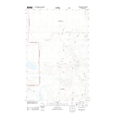
2013 Map of Dewey Lake NW
USGS Topo · Published 2013About this map
Superior National Forest encompasses the entirety of this landscape in St. Louis County, where a complex network of waterways defines the terrain. The Sturgeon River and its tributary, the E Br Sturgeon River, carve paths through the northern woods, joined by smaller streams such as Sand Cr and Murray Cr. This area is characterized by its numerous glacial lakes, including Luna Lake and Perch Lake in the central-west, while Shannon Lake feeds the Shannon River to the south. Forest access is provided by a grid of named routes like Dean Forest Rd and Goodell Rd. The map reveals the deep isolation of these timberlands, showing no permanent settlements but instead a quiet wilderness dominated by hydrography and forest service infrastructure.
Find a feature on this map
18 named features on this map. Tap any name to fly to it.
Don’t see what you’re looking for? This feature index may not catch every label — zoom into the map to look around manually.
Map Details
Editions of this 2013 Dewey Lake NW Map
This is the sole edition of this map. No revisions or reprints were ever made.
Other maps of this area

1954 · Hibbing
USGS Topo · 1:250,000

1955 · Dark Lake
USGS Topo · 1:24,000

1955 · Dewey Lake SE
USGS Topo · 1:24,000

1955 · Dewey Lake NW
USGS Topo · 1:24,000

1955 · Dewey Lake
USGS Topo · 1:24,000

1957 · Hibbing
USGS Topo · 1:250,000

1958 · Hibbing
USGS Topo · 1:250,000

1964 · Hibbing
USGS Topo · 1:250,000

1964 · Side Lake
USGS Topo · 1:24,000

1964 · Linden Grove
USGS Topo · 1:24,000