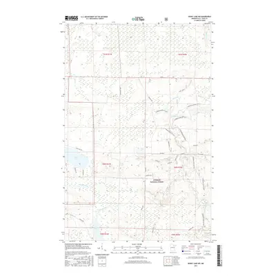
2016 Map of Dewey Lake NW
USGS Topo · Published 2016About this map
The Superior National Forest dominates this northern Minnesota landscape, revealing a complex network of waterways and forest management roads as they appeared in 2016. The Sturgeon River winds through the central and eastern portions of the quadrangle, subdivided into administrative segments such as Sturgeon River Section G and Sturgeon River Section C. These labels, along with the Taconite road and various spurs like Osborn Spur D, reflect the area's legacy of resource extraction and timber access. Water is a defining characteristic of the terrain, from the sprawling Perch Lake and smaller Luna Lake to the course of the Shannon River in the south. Named local corridors like Dean Forest Road and Prusak Road provide the primary access points into this dense, lacustrine environment near the border of t60n r20w.
Find a feature on this map
38 named features on this map. Tap any name to fly to it.
Don’t see what you’re looking for? This feature index may not catch every label — zoom into the map to look around manually.
Map Details
Editions of this 2016 Dewey Lake NW Map
This is the sole edition of this map. No revisions or reprints were ever made.
Other maps of this area

1954 · Hibbing
USGS Topo · 1:250,000

1955 · Dark Lake
USGS Topo · 1:24,000

1955 · Dewey Lake SE
USGS Topo · 1:24,000

1955 · Dewey Lake NW
USGS Topo · 1:24,000

1955 · Dewey Lake
USGS Topo · 1:24,000

1957 · Hibbing
USGS Topo · 1:250,000

1958 · Hibbing
USGS Topo · 1:250,000

1964 · Hibbing
USGS Topo · 1:250,000

1964 · Side Lake
USGS Topo · 1:24,000

1964 · Linden Grove
USGS Topo · 1:24,000