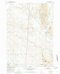
1951 Map of Dewey SW
USGS Topo · Published 1981About this map
Rattlesnake Ridge anchors this prairie landscape along the border of Weston and Niobrara counties, documenting a specialized water management system in a semi-arid environment. Surveyed mid-century, the map details a network of drainage and transport including a Ditch system and a notable Flume near Stockade Beaver Creek. These features, along with an Artesian Well and various Windmill sites, illustrate the critical importance of water rights and infrastructure for ranching and industry in eastern Wyoming.
Find a feature on this map
16 named features on this map. Tap any name to fly to it.
Don’t see what you’re looking for? This feature index may not catch every label — zoom into the map to look around manually.
Map Details
Editions of this 1951 Dewey SW Map
2 editions found
Other maps of this area

1899 · Newcastle
USGS Topo · 1:125,000

1901 · Newcastle
USGS Topo · 1:125,000

1951 · Owens
USGS Topo · 1:24,000

1951 · Dewey
USGS Topo · 1:24,000

1951 · Dewey SW
USGS Topo · 1:24,000

1951 · Twentyone Divide
USGS Topo · 1:24,000

1951 · Morrisey NE
USGS Topo · 1:24,000

1951 · Clifton
USGS Topo · 1:24,000

1955 · Newcastle
USGS Topo · 1:250,000

1958 · Newcastle
USGS Topo · 1:250,000