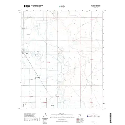
2020 Map of Dexter East
USGS Topo · Published 2020About this map
Dexter and Greenfield anchor the western edge of this Pecos River valley landscape, where human settlement is defined by an intricate network of irrigation and road systems. The presence of the Hagerman Canal and Durand Reservoir highlights the long-standing reliance on water management in Chaves County, facilitating the agricultural patterns that spread east toward the river's winding path. Named thoroughfares like Hidatsa Rd, Caddo Rd, and Comanche Rd suggest a layering of cultural history over the township and range divisions. The area around Lake Van serves as a local focal point just east of Dexter, while the Pecos River Bridge provides a vital crossing point. To the south, the map reaches the outskirts of Hagerman, capturing the transition between residential clusters and the open terrain of the river basin.
Find a feature on this map
44 named features on this map. Tap any name to fly to it.
Don’t see what you’re looking for? This feature index may not catch every label — zoom into the map to look around manually.
Map Details
Editions of this 2020 Dexter East Map
This is the sole edition of this map. No revisions or reprints were ever made.
Other maps of this area

1949 · Wade Ranch
USGS Topo · 1:24,000

1950 · Dexter West
USGS Topo · 1:24,000

1950 · Bottomless Lakes
USGS Topo · 1:24,000

1950 · South Spring
USGS Topo · 1:24,000

1950 · Dexter East
USGS Topo · 1:24,000

1951 · Ninemile Well
USGS Topo · 1:24,000

1951 · Hagerman
USGS Topo · 1:24,000

1952 · Bar C Bar Ranch
USGS Topo · 1:24,000

1952 · Hagerman SW
USGS Topo · 1:24,000

1955 · Roswell
USGS Topo · 1:250,000