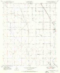
1950 Map of Dexter West
USGS Topo · Published 1972About this map
Arid grazing lands and emerging irrigation systems define this landscape west of Dexter, where the Atchison Topeka and Santa Fe railroad line runs parallel to the Hagerman Canal. The map reveals an economy transitioning between traditional ranching, represented by the Lowe Ranch and Williams Ranch, and specialized agricultural industry. This is evident in the presence of the Bogles Cotton Gin and several specialized aviation sites like the Cotton Dusters Landing Strip.
Find a feature on this map
20 named features on this map. Tap any name to fly to it.
Don’t see what you’re looking for? This feature index may not catch every label — zoom into the map to look around manually.
Map Details
Editions of this 1950 Dexter West Map
4 editions found
Other maps of this area

1949 · Peters Lake
USGS Topo · 1:24,000

1949 · Roswell South
USGS Topo · 1:24,000

1950 · Dexter West
USGS Topo · 1:24,000

1950 · Bottomless Lakes
USGS Topo · 1:24,000

1950 · South Spring
USGS Topo · 1:24,000

1950 · Dexter East
USGS Topo · 1:24,000

1951 · Hagerman
USGS Topo · 1:24,000

1952 · Hagerman SW
USGS Topo · 1:24,000

1955 · Hackberry Ranch
USGS Topo · 1:24,000

1955 · Roswell
USGS Topo · 1:250,000