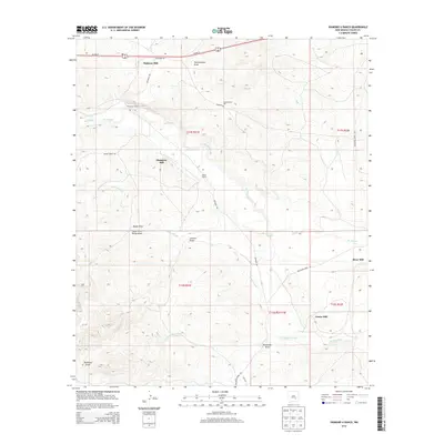
2013 Map of Diamond A Ranch
USGS Topo · Published 2013About this map
Diamond A Ranch and the White Ranch define the settlement pattern of this semi-arid Chaves County landscape, where water and industry are inextricably linked. The perennial course of the Rio Hondo and the seasonal drainages of Rocky Arroyo and the S Fork Rocky Arroyo dictate the placement of ranch infrastructure. A notable concentration of windmills and milling sites, including Highway Mill, Diamante Mill, and River Mill, reveals the critical reliance on groundwater for livestock across these high plains. The terrain is deeply inscribed by a system of natural draws, most notably Thirteenmile Draw, Johnson Draw, and Buchanan Draw, which serve as the primary conduits for drainage and historical movement through the region. Surveyed in the early 21st century, the map details a grid of local routes like Mossman Rd and Baton Rouge Rd that connect these remote working landscapes to the wider region.
Find a feature on this map
26 named features on this map. Tap any name to fly to it.
Don’t see what you’re looking for? This feature index may not catch every label — zoom into the map to look around manually.
Map Details
Editions of this 2013 Diamond A Ranch Map
This is the sole edition of this map. No revisions or reprints were ever made.
Other maps of this area

1949 · Hondo Reservoir
USGS Topo · 1:24,000

1949 · Juan Lake
USGS Topo · 1:24,000

1949 · Corn Ranch
USGS Topo · 1:24,000

1950 · Corn Ranch
USGS Topo · 1:24,000

1955 · Roswell
USGS Topo · 1:250,000

1956 · Diamond A Ranch
USGS Topo · 1:24,000

1958 · Roswell
USGS Topo · 1:250,000

1959 · Diamond A Ranch
USGS Topo · 1:24,000

1961 · Indian Bluff
USGS Topo · 1:62,500

1962 · Roswell
USGS Topo · 1:250,000