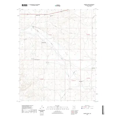
2020 Map of Diamond A Ranch
USGS Topo · Published 2020About this map
Rio Hondo and its intricate network of drainage channels define this Chaves County landscape, where ranching operations and industrial points mark the terrain. The presence of several distinct mills, including River Mill, Center Mill, Highway Mill, and Diamante Mill, suggests a specialized agricultural or industrial landscape tied to the water cycles of the arid West. The Diamond A Ranch serves as a primary local landmark, situated among the draws and arroyos that funnel seasonal water across the high plains. The map details a complex system of named ephemeral watercourses such as Thirteenmile Draw, Rocky Arroyo, and Buchanan Draw, which reveal the natural drainage patterns critical to land use in this part of New Mexico. Local infrastructure is represented by a grid of rural routes including Mossman Rd and Buchanan Rd, which connect the scattered ranching interests and industrial sites.
Find a feature on this map
23 named features on this map. Tap any name to fly to it.
Don’t see what you’re looking for? This feature index may not catch every label — zoom into the map to look around manually.
Map Details
Editions of this 2020 Diamond A Ranch Map
This is the sole edition of this map. No revisions or reprints were ever made.
Other maps of this area

1949 · Hondo Reservoir
USGS Topo · 1:24,000

1949 · Juan Lake
USGS Topo · 1:24,000

1949 · Corn Ranch
USGS Topo · 1:24,000

1950 · Corn Ranch
USGS Topo · 1:24,000

1955 · Roswell
USGS Topo · 1:250,000

1956 · Diamond A Ranch
USGS Topo · 1:24,000

1958 · Roswell
USGS Topo · 1:250,000

1959 · Diamond A Ranch
USGS Topo · 1:24,000

1961 · Indian Bluff
USGS Topo · 1:62,500

1962 · Roswell
USGS Topo · 1:250,000