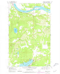
1968 Map of Diamond Lake
USGS Topo · Published 1981About this map
The Pend Oreille River flows across the northern section of this landscape, its banks defined by the small settlement of Dalkena and the siding at Furport. The southern half of the map centers on the community of Diamond Lake, a notable local destination featuring Cowles Camp and a public campground. The transit infrastructure of the late 1960s is anchored by the Chicago Milwaukee St Paul and Pacific railroad, which follows the river's curve and skirts Furport Hill. Between the river and the lake, the terrain rises into the highlands of Saddle Mountain, crisscrossed by the Coyote Trail and various Jeep Trails. Local industry and resource extraction are represented by scattered Gravel Pits and a Sandpit near Deer Valley, while smaller water bodies like Mountain Meadows Lake and Panhandle Lake dot the forested interior.
Find a feature on this map
30 named features on this map. Tap any name to fly to it.
Don’t see what you’re looking for? This feature index may not catch every label — zoom into the map to look around manually.
Map Details
Editions of this 1968 Diamond Lake Map
2 editions found
Other maps of this area

1936 · Newport
USGS Topo · 1:96,000

1942 · Newport
USGS Topo · 1:125,000

1958 · Sandpoint
USGS Topo · 1:250,000

1963 · Sandpoint
USGS Topo · 1:250,000

1968 · Cusick
USGS Topo · 1:24,000
1968 · Camden
USGS Topo · 1:24,000
1968 · Diamond Lake
USGS Topo · 1:24,000
1968 · Newport
USGS Topo · 1:24,000
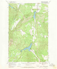
1968 · Sacheen Lake
USGS Topo · 1:24,000
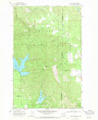
1968 · Bead Lake
USGS Topo · 1:24,000