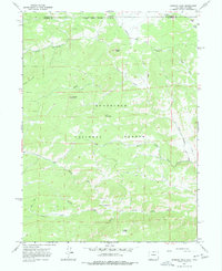
1967 Map of Diamond Peak
USGS Topo · Published 1977About this map
Roosevelt National Forest dominates this mountain landscape along the border between Colorado and Wyoming. Surveyed in the late 1960s, the terrain is defined by a series of prominent peaks and drainage systems, including the namesake Diamond Peak, Deadhorse Mountain, and Iron Mountain. Water from the north flows through high-altitude features like Kelsey Lake and Mill Creek Spring, eventually feeding into the North Fork Cache la Poudre River which carves through the southern portion of the quadrangle.
Find a feature on this map
28 named features on this map. Tap any name to fly to it.
Don’t see what you’re looking for? This feature index may not catch every label — zoom into the map to look around manually.
Map Details
Editions of this 1967 Diamond Peak Map
3 editions found
Other maps of this area

1895 · Laramie
USGS Topo · 1:125,000

1902 · Laramie
USGS Topo · 1:125,000

1905 · Sherman
USGS Topo · 1:125,000

1905 · Laramie
USGS Topo · 1:125,000

1906 · Laramie
USGS Topo · 1:125,000

1907 · Livermore
USGS Topo · 1:125,000

1908 · Laramie
USGS Topo · 1:125,000

1909 · Livermore
USGS Topo · 1:125,000

1916 · Home
USGS Topo · 1:125,000

1920 · Home
USGS Topo · 1:125,000