
1960 Map of Dianas Punch Bowl
USGS Topo · Published 1962About this map
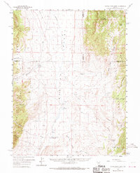
Dianas Punch Bowl (Hot Springs) sits as a thermal landmark within the expansive Monitor Valley, a basin flanked by the high ridges of the Monitor Range and the Toiyabe National Forest. This 1960 survey captures a high-desert landscape defined by its isolated cattle ranches and water sources. Human activity is clustered around essential springs and creeks, evidenced by the presence of Monitor Ranch, Potts Ranch, and Willow Creek Ranch. An airstrip near The Monitor and a network of jeep trails suggest the remote nature of this central Nevada region during the mid-20th century. The topography is meticulously detailed, showing the steep drainages of Ikes Canyon and Black Rock Canyon as they descend toward the flat valley floor where Stoneberger Creek and Willow Creek provide vital drainage for the arid environment.
Find a feature on this map
40 named features on this map. Tap any name to fly to it.
Don’t see what you’re looking for? This feature index may not catch every label — zoom into the map to look around manually.
Map Details
Editions of this 1960 Dianas Punch Bowl Map
3 editions found
Other maps of this area

1926 · Roberts Mountains
USGS Topo · 1:250,000

1929 · Roberts Mountains
USGS Topo · 1:250,000

1955 · Millett
USGS Topo · 1:250,000

1956 · Horse Heaven Mtn
USGS Topo · 1:62,500

1956 · Antelope Peak
USGS Topo · 1:62,500

1956 · Tonopah
USGS Topo · 1:250,000

1959 · Tonopah
USGS Topo · 1:250,000

1959 · Millett
USGS Topo · 1:250,000

1960 · Hickison Summit
USGS Topo · 1:62,500

1960 · Spencer Hot Springs
USGS Topo · 1:62,500