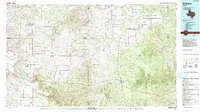
1985 Map of Dickens
USGS Topo · Published 1993About this map
The Croton Breaks dominate the southern landscape of this West Texas region, where the rugged drainages of the Salt Fork Brazos River and the various forks of the Wichita River converge. In the mid-1980s, this area remained characterized by small, dispersed ranching and farming communities such as Sneedville, Dumont, and Afton. The town of Dickens serves as a central hub, while to the east, Guthrie sits near the sprawling Pitchfork Flats.
Find a feature on this map
64 named features on this map. Tap any name to fly to it.
Don’t see what you’re looking for? This feature index may not catch every label — zoom into the map to look around manually.
Map Details
Editions of this 1985 Dickens Map
2 editions found

Other maps of this area

1932 · Vivian
USGS Topo · 1:62,500

1954 · Lubbock
USGS Topo · 1:250,000

1954 · Plainview
USGS Topo · 1:250,000

1954 · Wichita Falls
USGS Topo · 1:250,000

1955 · Lawton
USGS Topo · 1:250,000

1958 · Wichita Falls
USGS Topo · 1:250,000

1958 · Plainview
USGS Topo · 1:250,000

1958 · Pursley House
USGS Topo · 1:24,000

1958 · Southerland Canyon
USGS Topo · 1:24,000

1959 · Gilpin
USGS Topo · 1:24,000