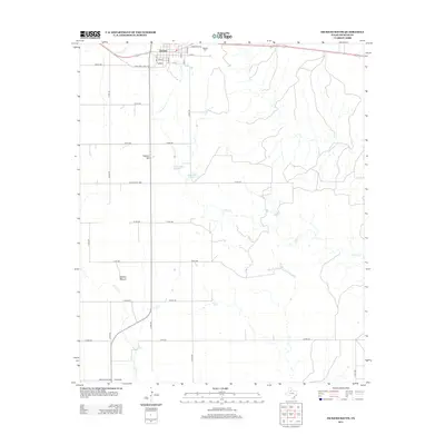
2012 Map of Dickens South
USGS Topo · Published 2012About this map
Dickens serves as the focal point of this Dickens County landscape, showing the town's street grid and the nearby Blair area as they appeared in 2012. The survey highlights a mix of rural infrastructure and natural drainage patterns, with the waters of Croton Cr and Duck Cr winding through the terrain. To the north, the Dickens Cem provides a point of interest for genealogists, while the geography is further defined by distinctive elevations like Cathey Hill and the prominent Soldier Mound. A network of rural routes, including Ranch Road 1868 and various county roads, connects the small settlement to outlying features such as Lehew Lake Number 1 and Lehew Lake Number 2, illustrating the sparse but organized settlement pattern characteristic of the Texas Panhandle-Plains region.
Find a feature on this map
36 named features on this map. Tap any name to fly to it.
Don’t see what you’re looking for? This feature index may not catch every label — zoom into the map to look around manually.
Map Details
Editions of this 2012 Dickens South Map
This is the sole edition of this map. No revisions or reprints were ever made.
Other maps of this area

1954 · Lubbock
USGS Topo · 1:250,000

1959 · Gilpin
USGS Topo · 1:24,000

1967 · Dickens North
USGS Topo · 1:24,000

1967 · Dickens South
USGS Topo · 1:24,000

1967 · Spur
USGS Topo · 1:24,000

1967 · Haystack Mountain
USGS Topo · 1:24,000

1967 · Spur NW
USGS Topo · 1:24,000

1968 · East Afton
USGS Topo · 1:24,000

1968 · Foreman Chapel
USGS Topo · 1:24,000

1968 · Croton Camp
USGS Topo · 1:24,000