
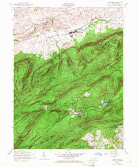
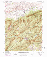
1952 Map of Dickinson
USGS Topo · Published 1958About this map
Yellow Breeches Creek defines the northern lowlands of this 1952 topographic survey, winding through a cluster of agricultural and early industrial settlements including Dickinson, Huntsdale, and Brushtown. The landscape is sharply divided between the valley's Reading railroad corridor and the steep, wooded rise of South Mountain. This elevation change creates a distinct boundary between the farming communities of Penn township and the recreational and conservation lands to the south.
Find a feature on this map
58 named features on this map. Tap any name to fly to it.
Don’t see what you’re looking for? This feature index may not catch every label — zoom into the map to look around manually.
Map Details
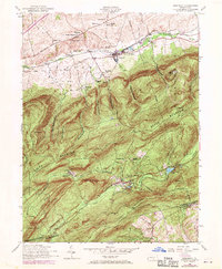
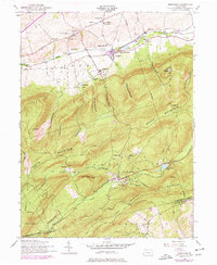
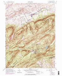
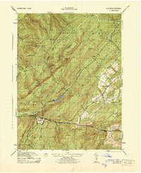
Editions of this 1952 Dickinson Map
6 editions found
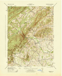
Other maps of this area

1904 · Carlisle
USGS Topo · 1:62,500

1908 · Gettysburg
USGS Topo · 1:62,500

1909 · Fairfield
USGS Topo · 1:62,500

1919 · Newville
USGS Topo · 1:62,500

1942 · Gettysburg
USGS Topo · 1:125,000

1943 · Carlisle
USGS Topo · 1:62,500
1944 · Flat Ridge
USGS Topo · 1:31,680
1944 · Arendtsville
USGS Topo · 1:31,680
1944 · Biglerville
USGS Topo · 1:31,680

1945 · Newville
USGS Topo · 1:62,500
Featured Places
- Dickinson, Penn Township
- Southampton Township, PA
- Cooke Township, PA
- Cumminsville, Penn Township
- Longsdorf, Penn Township