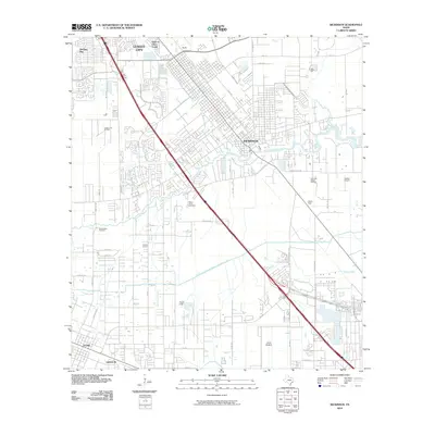
2010 Map of Dickinson
USGS Topo · Published 2010About this map
Dickinson Bayou snakes through this coastal landscape, anchoring the development of Dickinson and the surrounding reaches of League City. The transition from mid-century industry to modern residential expansion is evident in the proximity of the League City Oil Field and Dickinson Gillock Oil Field to newer subdivisions like Brittany Bay and Oaks of Clear Creek. Historical land use is preserved in landmarks such as Camp Wallace and the Old Arcadia Cemetery, while the Galveston County Water Company Canal provides a structural reminder of the region's managed water resources. Southward, the map details the grid-like settlements of Arcadia and Santa Fe, showing the area's continued reliance on local road networks like Texas Ave and Palmer Hwy.
Find a feature on this map
50 named features on this map. Tap any name to fly to it.
Don’t see what you’re looking for? This feature index may not catch every label — zoom into the map to look around manually.
Map Details
Editions of this 2010 Dickinson Map
This is the sole edition of this map. No revisions or reprints were ever made.
Other maps of this area

1916 · Genoa
USGS Topo · 1:24,000

1916 · Seabrook
USGS Topo · 1:24,000

1920 · Seabrook
USGS Topo · 1:31,680

1920 · Genoa
USGS Topo · 1:31,680

1929 · Dickinson
USGS Topo · 1:24,000

1929 · Algoa
USGS Topo · 1:24,000

1929 · Hitchcock
USGS Topo · 1:24,000

1929 · Virginia Point
USGS Topo · 1:24,000

1929 · Texas City
USGS Topo · 1:24,000

1932 · Algoa
USGS Topo · 1:31,680