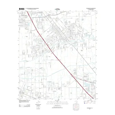
2013 Map of Dickinson
USGS Topo · Published 2013About this map
Dickinson Bayou winds through the heart of this coastal Texas landscape, reflecting a region defined by industrial energy and suburban expansion. The infrastructure of the petroleum industry is prominent, with the League City Oil Field and Dickinson Gillock Oil Field marking the land. Transportation corridors dominate the geography, centered on the heavy diagonal line of the Gulf Fwy, which connects the residential clusters of Arcadia and Brittany Bay to the larger regional network. Local heritage and community foundations are visible at sites like Mt Olivet Cem and the former military grounds of Camp Wallace. The presence of Laseair Airport and Rebel Field Airport highlights the area's aviation history, while the Galveston County Water Company Canal provides a look at the essential water management systems supporting this developed coastal corridor.
Find a feature on this map
26 named features on this map. Tap any name to fly to it.
Don’t see what you’re looking for? This feature index may not catch every label — zoom into the map to look around manually.
Map Details
Editions of this 2013 Dickinson Map
This is the sole edition of this map. No revisions or reprints were ever made.
Other maps of this area

1916 · Genoa
USGS Topo · 1:24,000

1916 · Seabrook
USGS Topo · 1:24,000

1920 · Seabrook
USGS Topo · 1:31,680

1920 · Genoa
USGS Topo · 1:31,680

1929 · Dickinson
USGS Topo · 1:24,000

1929 · Algoa
USGS Topo · 1:24,000

1929 · Hitchcock
USGS Topo · 1:24,000

1929 · Virginia Point
USGS Topo · 1:24,000

1929 · Texas City
USGS Topo · 1:24,000

1932 · Algoa
USGS Topo · 1:31,680