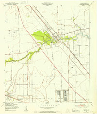
1943 Map of Dickinson
USGS Topo · Published 1953About this map
Camp Wallace dominates the southeastern portion of this coastal Texas landscape, reflecting the military mobilization of the early 1940s. Situated in Galveston County, the area is defined by the winding course of Dickinson Bayou, which serves as a central artery for the settlements of Dickinson and Oleander. The settlement pattern follows both the water and the At&SF railroad, which passes through Arcadia in the southwest corner. The map reveals an economy transitioning between traditional agriculture, indicated by numerous Windmill sites, and the growing petroleum industry, marked by scattered Oil Wells. Local life is anchored by institutions like the Santa Fe Consolidated Sch and the Arcadia Cem, while the presence of a Swimming Pool along the bayou suggests the community's early recreational development. The landscape is a flat coastal plain, heavily influenced by the drainage systems of Gum Bayou and Moses Bayou.
Find a feature on this map
25 named features on this map. Tap any name to fly to it.
Don’t see what you’re looking for? This feature index may not catch every label — zoom into the map to look around manually.
Map Details
Editions of this 1943 Dickinson Map
This is the sole edition of this map. No revisions or reprints were ever made.
Other maps of this area

1916 · Genoa
USGS Topo · 1:24,000

1916 · Seabrook
USGS Topo · 1:24,000

1920 · Seabrook
USGS Topo · 1:31,680

1920 · Genoa
USGS Topo · 1:31,680

1929 · Dickinson
USGS Topo · 1:24,000

1929 · Algoa
USGS Topo · 1:24,000

1929 · Hitchcock
USGS Topo · 1:24,000

1929 · Virginia Point
USGS Topo · 1:24,000

1929 · Texas City
USGS Topo · 1:24,000

1932 · Algoa
USGS Topo · 1:31,680