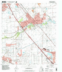
1995 Map of Dickinson
USGS Topo · Published 1999About this map
Dickinson and League City dominate this coastal Texas landscape, showcasing the post-war suburban and industrial expansion along the corridor toward Texas City. The geography is defined by the winding course of Dickinson Bayou and Moses Bayou, which provide critical drainage for the low-lying terrain. Significant cultural markers include the sprawling Mt Olivet Cemetery and educational sites like Dunbar Sch and the Santa Fe Sch in the settlement of Arcadia.
Find a feature on this map
23 named features on this map. Tap any name to fly to it.
Don’t see what you’re looking for? This feature index may not catch every label — zoom into the map to look around manually.
Map Details
Editions of this 1995 Dickinson Map
This is the sole edition of this map. No revisions or reprints were ever made.
Other maps of this area

1916 · Genoa
USGS Topo · 1:24,000

1916 · Seabrook
USGS Topo · 1:24,000

1920 · Seabrook
USGS Topo · 1:31,680

1920 · Genoa
USGS Topo · 1:31,680

1929 · Dickinson
USGS Topo · 1:24,000

1929 · Algoa
USGS Topo · 1:24,000

1929 · Hitchcock
USGS Topo · 1:24,000

1929 · Virginia Point
USGS Topo · 1:24,000

1929 · Texas City
USGS Topo · 1:24,000

1932 · Algoa
USGS Topo · 1:31,680