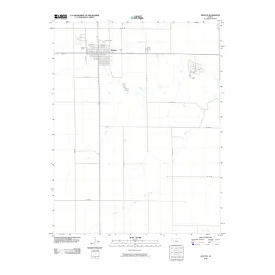
2009 Map of Dighton
USGS Topo · Published 2009About this map
Dighton serves as the central hub of this High Plains landscape, organized around a rigid grid of residential streets and essential services. The town's layout is bordered to the west by the Dighton Airport and to the east by the Dighton Cemetery, which remains a key site for local genealogical research. North-south transit is dominated by State Hwy 23, a corridor that intersects with the town's east-west streets like W Dighton St. Outside the immediate settlement, the terrain is defined by the winding paths of the South Fork Walnut Creek and Buffalo Creek. This drainage pattern illustrates the importance of water management in Lane County, where rural section roads such as Mustang Rd and Longhorn Rd segment the open expanses of the surrounding agricultural land.
Find a feature on this map
21 named features on this map. Tap any name to fly to it.
Don’t see what you’re looking for? This feature index may not catch every label — zoom into the map to look around manually.
Map Details
Editions of this 2009 Dighton Map
This is the sole edition of this map. No revisions or reprints were ever made.
Other maps of this area

1955 · Scott City
USGS Topo · 1:250,000

1958 · Scott City
USGS Topo · 1:250,000

1974 · Dighton SW
USGS Topo · 1:24,000

1974 · Amy SE
USGS Topo · 1:24,000

1974 · Dighton
USGS Topo · 1:24,000

1974 · Alamota
USGS Topo · 1:24,000

1974 · Dighton SE
USGS Topo · 1:24,000

1974 · Amy
USGS Topo · 1:24,000

1974 · Healy
USGS Topo · 1:24,000

1974 · Shields SE
USGS Topo · 1:24,000