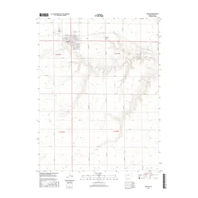
2015 Map of Dighton
USGS Topo · Published 2015About this map
Dighton serves as the central hub for this High Plains landscape, situated at the intersection of local routes and the northern reaches of several creek systems. The town's grid is clearly defined by named thoroughfares like E Annabella St, W Dighton St, and E Lincoln St, reflecting its role as the seat of Lane County. Just outside the main residential blocks, the Dighton Airport and Dighton Cem provide local reference points for researchers tracing the community's infrastructure and genealogy.
Find a feature on this map
28 named features on this map. Tap any name to fly to it.
Don’t see what you’re looking for? This feature index may not catch every label — zoom into the map to look around manually.
Map Details
Editions of this 2015 Dighton Map
This is the sole edition of this map. No revisions or reprints were ever made.
Other maps of this area

1955 · Scott City
USGS Topo · 1:250,000

1958 · Scott City
USGS Topo · 1:250,000

1974 · Dighton SW
USGS Topo · 1:24,000

1974 · Amy SE
USGS Topo · 1:24,000

1974 · Dighton
USGS Topo · 1:24,000

1974 · Alamota
USGS Topo · 1:24,000

1974 · Dighton SE
USGS Topo · 1:24,000

1974 · Amy
USGS Topo · 1:24,000

1974 · Healy
USGS Topo · 1:24,000

1974 · Shields SE
USGS Topo · 1:24,000