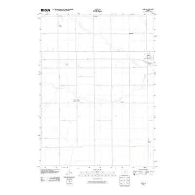
2010 Map of Dike
USGS Topo · Published 2010About this map
Dike sits at the northeastern edge of this Grundy County landscape, where the North Fork Black Hawk Creek winds through the agricultural terrain. The region is defined by a rigorous grid of section-line roads, including Cole and Stout, which connect small outlying settlements like Sinclair, Swanton, and Dairyville. These crossroads communities reflect the late 20th-century rural character of the area, anchored by family and community history preserved in numerous burial grounds.
Find a feature on this map
34 named features on this map. Tap any name to fly to it.
Don’t see what you’re looking for? This feature index may not catch every label — zoom into the map to look around manually.
Map Details
Editions of this 2010 Dike Map
This is the sole edition of this map. No revisions or reprints were ever made.
Other maps of this area

1954 · Waterloo
USGS Topo · 1:250,000

1955 · Waterloo
USGS Topo · 1:250,000

1971 · Zaneta
USGS Topo · 1:24,000

1971 · Dike
USGS Topo · 1:24,000

1971 · Lincoln
USGS Topo · 1:24,000

1971 · Stout
USGS Topo · 1:24,000

1971 · Reinbeck
USGS Topo · 1:24,000
1971 · New Hartford
USGS Topo · 1:24,000

1979 · Grundy Center
USGS Topo · 1:24,000

1979 · Holland
USGS Topo · 1:24,000