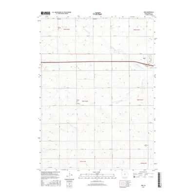
2015 Map of Dike
USGS Topo · Published 2015About this map
The town of Dike anchors the northeastern portion of this Grundy County landscape, where the agricultural grid meets the winding courses of the N Fork Black Hawk Cr and S Fork Black Hawk Cr. This 2015 survey illustrates a highly organized rural structure, dominated by section-line roads like 160th St and Co Rd D25. For local historians and genealogists, the map is particularly valuable for its documentation of township-specific landmarks, including the Beaver Township Cem in the northwest and Grant Township Cem in the southeast. Smaller named locales such as Sinclair and Swanton reflect the historical footprint of earlier settlement patterns. The map detail extends to the street level in Dike, showing Main St and Luitjens Ln near Elmwood Cem, providing a precise record of the community's modern layout amidst the surrounding prairie and farmland.
Find a feature on this map
32 named features on this map. Tap any name to fly to it.
Don’t see what you’re looking for? This feature index may not catch every label — zoom into the map to look around manually.
Map Details
Editions of this 2015 Dike Map
This is the sole edition of this map. No revisions or reprints were ever made.
Other maps of this area

1954 · Waterloo
USGS Topo · 1:250,000

1955 · Waterloo
USGS Topo · 1:250,000

1971 · Zaneta
USGS Topo · 1:24,000

1971 · Dike
USGS Topo · 1:24,000

1971 · Lincoln
USGS Topo · 1:24,000

1971 · Stout
USGS Topo · 1:24,000

1971 · Reinbeck
USGS Topo · 1:24,000
1971 · New Hartford
USGS Topo · 1:24,000

1979 · Grundy Center
USGS Topo · 1:24,000

1979 · Holland
USGS Topo · 1:24,000