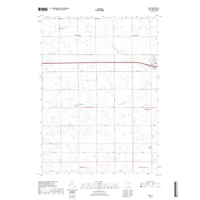
2018 Map of Dike
USGS Topo · Published 2018About this map
The town of Dike serves as the primary hub in this portion of Grundy County, situated where the terrain transitions from the headwaters of N Fork Black Hawk Cr to the more southern reaches of S Fork Black Hawk Cr. The landscape is dominated by the geometric precision of the Public Land Survey System, with a dense grid of rural roads such as 160th St and Co Rd D25 connecting dispersed farmsteads and agricultural operations.
Find a feature on this map
33 named features on this map. Tap any name to fly to it.
Don’t see what you’re looking for? This feature index may not catch every label — zoom into the map to look around manually.
Map Details
Editions of this 2018 Dike Map
This is the sole edition of this map. No revisions or reprints were ever made.
Other maps of this area

1954 · Waterloo
USGS Topo · 1:250,000

1955 · Waterloo
USGS Topo · 1:250,000

1971 · Zaneta
USGS Topo · 1:24,000

1971 · Dike
USGS Topo · 1:24,000

1971 · Lincoln
USGS Topo · 1:24,000

1971 · Stout
USGS Topo · 1:24,000

1971 · Reinbeck
USGS Topo · 1:24,000
1971 · New Hartford
USGS Topo · 1:24,000

1979 · Grundy Center
USGS Topo · 1:24,000

1979 · Holland
USGS Topo · 1:24,000