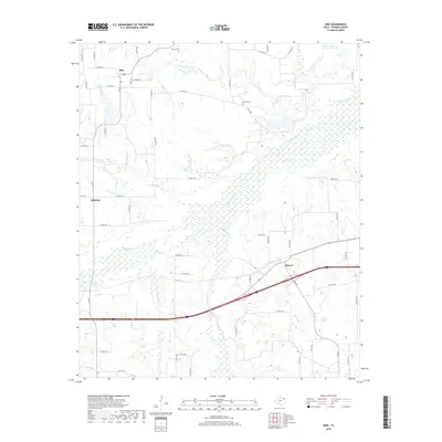
2019 Map of Dike
USGS Topo · Published 2019About this map
Dike and the surrounding Hopkins County countryside are defined by a complex network of creeks and small family cemeteries in this 2019 survey. The settlement of Mahoney and the crossroads at Weaver anchor the rural landscape, which is heavily bisected by watercourses like White Oak Cr and Crosstimber Cr. These drainages create a series of low-lying basins and wetlands, notably around Richland Cr and Rock Cr.
Find a feature on this map
57 named features on this map. Tap any name to fly to it.
Don’t see what you’re looking for? This feature index may not catch every label — zoom into the map to look around manually.
Map Details
Editions of this 2019 Dike Map
This is the sole edition of this map. No revisions or reprints were ever made.
Other maps of this area

1953 · Texarkana
USGS Topo · 1:250,000

1956 · Texarkana
USGS Topo · 1:250,000

1962 · Sulphur Bluff
USGS Topo · 1:24,000

1963 · Mitchell Creek
USGS Topo · 1:24,000

1964 · Saltillo
USGS Topo · 1:24,000

1964 · Como
USGS Topo · 1:24,000

1964 · Purley
USGS Topo · 1:24,000

1964 · Sulphur Springs
USGS Topo · 1:24,000

1964 · Tira
USGS Topo · 1:24,000
1964 · Sulphur Springs SE
USGS Topo · 1:24,000