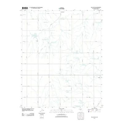
2012 Map of Dill City SE
USGS Topo · Published 2012About this map
Old Boggy Cem and Sod Cem stand as quiet landmarks within this rural Oklahoma landscape southeast of Dill City. The terrain is defined by a sophisticated water management system, featuring numerous numbered reservoirs such as Boggy Cr Watershed Site 15 Reservoir and Cavalry Cr Watershed 22 Reservoir. These structures are critical to the agricultural life of the region, managing the flow of Boggy Cr and Cavalry Cr across the plains.
Find a feature on this map
42 named features on this map. Tap any name to fly to it.
Don’t see what you’re looking for? This feature index may not catch every label — zoom into the map to look around manually.
Map Details
Editions of this 2012 Dill City SE Map
This is the sole edition of this map. No revisions or reprints were ever made.
Other maps of this area

1955 · Clinton
USGS Topo · 1:250,000

1956 · Cordell
USGS Topo · 1:62,500

1957 · Clinton
USGS Topo · 1:250,000

1957 · Dill City
USGS Topo · 1:62,500

1961 · Gotebo
USGS Topo · 1:62,500

1961 · Hobart
USGS Topo · 1:62,500

1976 · Dill City NE
USGS Topo · 1:24,000

1976 · Dill City SE
USGS Topo · 1:24,000
1983 · Bessie
USGS Topo · 1:24,000
1983 · Foss
USGS Topo · 1:24,000