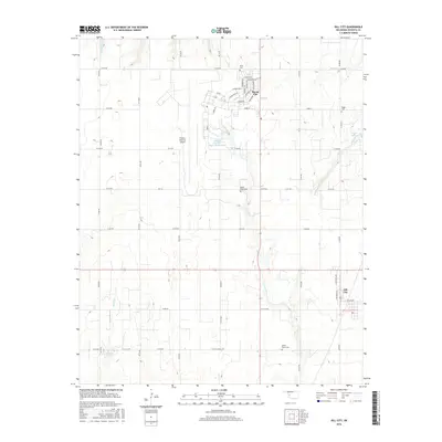
2016 Map of Dill City
USGS Topo · Published 2016About this map
Burns Flat and Dill City anchor this western Oklahoma landscape, characterized by a transition from traditional rural ranching to modern industrial infrastructure. The presence of the Clinton-Sherman Airport dominates the central portion of the map, situated near the Clinton-Sherman Reservoir. This large aviation facility is surrounded by a grid of rural roads and residential streets with names like Choctaw Rd and Mohawk Trl, reflecting the area's mid-century expansion.
Find a feature on this map
53 named features on this map. Tap any name to fly to it.
Don’t see what you’re looking for? This feature index may not catch every label — zoom into the map to look around manually.
Map Details
Editions of this 2016 Dill City Map
This is the sole edition of this map. No revisions or reprints were ever made.
Other maps of this area

1955 · Clinton
USGS Topo · 1:250,000

1957 · Clinton
USGS Topo · 1:250,000

1957 · Dill City
USGS Topo · 1:62,500

1961 · Hobart
USGS Topo · 1:62,500

1961 · Retrop
USGS Topo · 1:62,500

1961 · Elk City
USGS Topo · 1:62,500

1976 · Dill City NE
USGS Topo · 1:24,000

1976 · Dill City SE
USGS Topo · 1:24,000
1983 · Foss
USGS Topo · 1:24,000

1983 · Dill City
USGS Topo · 1:24,000