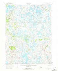
1952 Map of Dillingham A-4
USGS Topo · Published 1972About this map
Kuagrak Creek winds through a vast expanse of wetlands and small lakes in this 1952 topographic study of the Dillingham region. The landscape is characterized by a high density of kettle lakes and meandering waterways, illustrating the post-glacial hydrology of the Alaska coastal plain before modern infrastructure was established. This area remains largely undeveloped, with no roads or trails recorded at the time of the survey, preserving a glimpse into the pristine drainage patterns of the Seward Meridian. The Kuagrak Creek system serves as the primary named hydrological feature, providing a critical reference point for researchers studying the historical environmental conditions of the Bristol Bay watershed.
Find a feature on this map
1 named feature on this map. Tap any name to fly to it.
Don’t see what you’re looking for? This feature index may not catch every label — zoom into the map to look around manually.
Map Details
Editions of this 1952 Dillingham A-4 Map
2 editions found
Other maps of this area

1951 · Dillingham
USGS Topo · 1:250,000

1952 · Naknek
USGS Topo · 1:250,000

1952 · Dillingham A-5
USGS Topo · 1:63,360

1952 · Dillingham A-4
USGS Topo · 1:63,360

1952 · Naknek D-5
USGS Topo · 1:63,360

1952 · Dillingham A-3
USGS Topo · 1:63,360

1952 · Naknek D-4
USGS Topo · 1:63,360

1954 · Dillingham
USGS Topo · 1:250,000

1954 · Dillingham B-4
USGS Topo · 1:63,360

1954 · Dillingham B-3
USGS Topo · 1:63,360