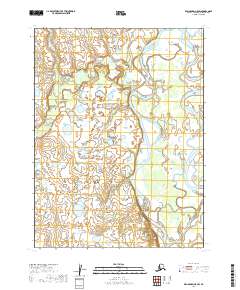
2019 Map of Dillingham A-5 SW
USGS Topo · Published 2019About this map
The Nushagak River dominates this southwestern Alaska landscape, showing a complex network of braided channels and meanders as it flows through the Dillingham Census Area. The water-rich terrain is defined by the significant branching of the Keefer Cutoff to the east and the winding course of the Iowithla River entering from the west. This 2019 survey, utilizing data from the National Hydrography Dataset and the Bureau of Land Management, documents a vast wetland environment where the shifting river paths create numerous small islands and seasonal channels. The area is largely defined by its natural hydrology, with very few man-made structures or named settlements recorded on this particular sheet.
Find a feature on this map
8 named features on this map. Tap any name to fly to it.
Don’t see what you’re looking for? This feature index may not catch every label — zoom into the map to look around manually.
Map Details
Editions of this 2019 Dillingham A-5 SW Map
This is the sole edition of this map. No revisions or reprints were ever made.
Other maps of this area

1951 · Dillingham
USGS Topo · 1:250,000

1952 · Naknek
USGS Topo · 1:250,000

1952 · Dillingham A-5
USGS Topo · 1:63,360

1952 · Dillingham A-6
USGS Topo · 1:63,360

1952 · Naknek D-6
USGS Topo · 1:63,360

1954 · Dillingham
USGS Topo · 1:250,000

1964 · Naknek
USGS Topo · 1:250,000
2019 · Naknek D-6 NE
USGS Topo · 1:25,000
2019 · Dillingham A-5 SE
USGS Topo · 1:25,000
2019 · Dillingham A-5 NE
USGS Topo · 1:25,000