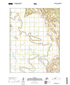
2019 Map of Dillingham A-8 SE
USGS Topo · Published 2019About this map
The Snake River dominates this landscape in the Dillingham Census Area, winding through a complex network of wetlands and oxbow lakes. This 2019 survey, produced by the U.S. Geological Survey, illustrates the intricate fluvial patterns and the low-elevation terrain that characterize this part of Alaska. The map defines the boundaries of townships including t12s r57w, t12s r56w, t13s r57w, and t13s r56w. Without established roads or settlements in this specific quadrangle, the hydrology of the river system remains the primary geographical landmark for navigation and environmental study.
Find a feature on this map
5 named features on this map. Tap any name to fly to it.
Don’t see what you’re looking for? This feature index may not catch every label — zoom into the map to look around manually.
Map Details
Editions of this 2019 Dillingham A-8 SE Map
This is the sole edition of this map. No revisions or reprints were ever made.
Other maps of this area

1945 · Nushagak Bay
USGS Topo · 1:250,000

1948 · Nushagak Bay D-3
USGS Topo · 1:63,360

1949 · Nushagak Bay
USGS Topo · 1:250,000

1951 · Dillingham
USGS Topo · 1:250,000

1951 · Nushagak Bay
USGS Topo · 1:250,000

1952 · Nushagak Bay D-3
USGS Topo · 1:63,360

1952 · Dillingham A-8
USGS Topo · 1:63,360

1952 · Dillingham A-7
USGS Topo · 1:63,360
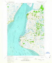
1952 · Nushagak Bay D-2
USGS Topo · 1:63,360

1954 · Dillingham
USGS Topo · 1:250,000