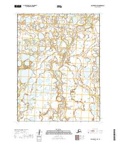
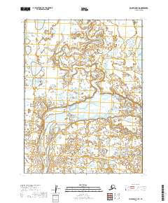
2019 Map of Dillingham B-1 NE
USGS Topo · Published 2019About this map
Kaskunak Cr meanders through this landscape of the Lake and Peninsula Borough, defining a complex network of wetlands and small water bodies. The terrain is characterized by a high density of thaw lakes and ponds, typical of the coastal lowlands in southwestern Alaska. The absence of roads or established settlements on this sheet highlights the isolated nature of the area, where the hydrological pattern is the dominant physical influence. Public land surveys demarcate the territory into townships such as t8s r40w and t9s r41w, providing a structural grid over an otherwise organic, water-logged environment. This map is a record of the shifting hydrography and intricate drainage systems of the region in the early twenty-first century.
Find a feature on this map
5 named features on this map. Tap any name to fly to it.
Don’t see what you’re looking for? This feature index may not catch every label — zoom into the map to look around manually.
Map Details
Editions of this 2019 Dillingham B-1 NE Map
This is the sole edition of this map. No revisions or reprints were ever made.
Other maps of this area

1951 · Dillingham
USGS Topo · 1:250,000

1952 · Iliamna
USGS Topo · 1:250,000

1954 · Iliamna C-8
USGS Topo · 1:63,360

1954 · Dillingham
USGS Topo · 1:250,000
1954 · Iliamna B-8
USGS Topo · 1:63,360

1954 · Dillingham C-1
USGS Topo · 1:63,360
1954 · Dillingham B-1
USGS Topo · 1:63,360

1957 · Iliamna
USGS Topo · 1:250,000
2019 · Iliamna C-8 SW
USGS Topo · 1:25,000
2019 · Dillingham B-1 SE
USGS Topo · 1:25,000