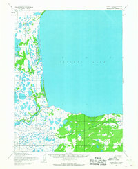
1954 Map of Iliamna B-8
USGS Topo · Published 1968About this map
Iliamna Lake dominates the landscape of this 1954 survey, meeting the shore at the headwaters of the Kvichak River. The settlement of Igiugig is situated at this critical geographic junction, serving as a gateway between the massive freshwater lake and the drainage leading toward Bristol Bay. Mapping by the Army Map Service reveals a modest community infrastructure including a Cem and a Landing Strip, emphasizing the importance of air travel for this part of Alaska during the mid-1950s.
Find a feature on this map
8 named features on this map. Tap any name to fly to it.
Don’t see what you’re looking for? This feature index may not catch every label — zoom into the map to look around manually.
Map Details
Editions of this 1954 Iliamna B-8 Map
This is the sole edition of this map. No revisions or reprints were ever made.
Other maps of this area

1951 · Dillingham
USGS Topo · 1:250,000

1951 · Iliamna A-7
USGS Topo · 1:63,360

1951 · Iliamna A-8
USGS Topo · 1:63,360

1951 · Iliamna B-7
USGS Topo · 1:63,360

1951 · Dillingham A-1
USGS Topo · 1:63,360

1952 · Iliamna
USGS Topo · 1:250,000
1952 · Iliamna A-8
USGS Topo · 1:63,360

1954 · Iliamna C-8
USGS Topo · 1:63,360

1954 · Dillingham
USGS Topo · 1:250,000
1954 · Iliamna C-7
USGS Topo · 1:63,360