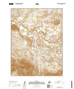
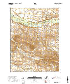
2019 Map of Dillingham C-1 NW
USGS Topo · Published 2019About this map
Stuyahok River defines the landscape of this remote subarctic region as it flows through the lowlands of the Dillingham Census Area. The terrain is characterized by a complex network of wetlands and small water bodies that predominate throughout the central and eastern portions of the map. These marshes and ponds highlight a classic Alaskan interior drainage pattern, where the slow-moving river meanders through a relatively flat expanse before the land rises into more defined topographical contours in the southern and western sections. This 2019 survey documents the natural hydrography of the Alaskan wilderness, showing the untouched character of the land within the t5s r42w, t5s r41w, t6s r42w, and t6s r41w townships.
Find a feature on this map
5 named features on this map. Tap any name to fly to it.
Don’t see what you’re looking for? This feature index may not catch every label — zoom into the map to look around manually.
Map Details
Editions of this 2019 Dillingham C-1 NW Map
This is the sole edition of this map. No revisions or reprints were ever made.
Other maps of this area

1951 · Dillingham
USGS Topo · 1:250,000

1954 · Dillingham
USGS Topo · 1:250,000

1954 · Dillingham D-2
USGS Topo · 1:63,360

1954 · Dillingham C-1
USGS Topo · 1:63,360

1954 · Dillingham C-2
USGS Topo · 1:63,360

1954 · Dillingham D-1
USGS Topo · 1:63,360
2019 · Dillingham D-2 SE
USGS Topo · 1:25,000
2019 · Dillingham D-1 SE
USGS Topo · 1:25,000
2019 · Dillingham C-1 SW
USGS Topo · 1:25,000
2019 · Dillingham C-2 NE
USGS Topo · 1:25,000