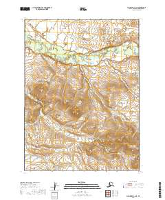
2019 Map of Dillingham C-2 NE
USGS Topo · Published 2019About this map
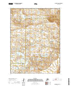
Stuyahok Hills dominate the central terrain of this wilderness area in the Dillingham Census Area of Alaska. This 2019 survey documents a landscape defined by dramatic elevation changes and intricate water systems, most notably the meandering course of the Stuyahok River as it winds through the northern sections of the map. The topography reveals a complex network of wetlands and small ponds scattered across the southern lowlands, contrasting with the high ridges of the interior hills. While devoid of named settlements or roads, the map provides a precise layout of the Public Land Survey System (PLSS) grid, spanning multiple townships including t5s r43w and t6s r42w. The detailed contouring and hydrography illustrate a remote environment where the natural drainage patterns and topographical landmarks are the primary navigational features.
Find a feature on this map
6 named features on this map. Tap any name to fly to it.
Don’t see what you’re looking for? This feature index may not catch every label — zoom into the map to look around manually.
Map Details
Editions of this 2019 Dillingham C-2 NE Map
This is the sole edition of this map. No revisions or reprints were ever made.
Other maps of this area

1951 · Dillingham
USGS Topo · 1:250,000

1954 · Dillingham
USGS Topo · 1:250,000

1954 · Dillingham D-2
USGS Topo · 1:63,360

1954 · Dillingham C-1
USGS Topo · 1:63,360

1954 · Dillingham C-2
USGS Topo · 1:63,360

1954 · Dillingham D-1
USGS Topo · 1:63,360
2019 · Dillingham D-2 SE
USGS Topo · 1:25,000
2019 · Dillingham C-1 SW
USGS Topo · 1:25,000
2019 · Dillingham C-2 NW
USGS Topo · 1:25,000
2019 · Dillingham C-2 SE
USGS Topo · 1:25,000