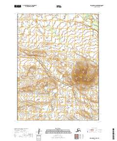
2019 Map of Dillingham C-2 NW
USGS Topo · Published 2019About this map
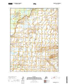
Stuyahok River winds through the northeastern corner of this landscape, marking a prominent watercourse in an otherwise vast expanse of wetlands and undulating terrain. Situated within the Dillingham Census Area, this 2019 survey delineates the township and range lines of t5s r44w, t5s r43w, t6s r44w, and t6s r43w. The map illustrates a region defined by complex hydrography and varying elevations, where natural drainage patterns dictate the character of the land. This documentation provides a modern geographic baseline for the area just north of the Dillingham coast, showing the relationship between the river system and the underlying public land survey grid.
Find a feature on this map
5 named features on this map. Tap any name to fly to it.
Don’t see what you’re looking for? This feature index may not catch every label — zoom into the map to look around manually.
Map Details
Editions of this 2019 Dillingham C-2 NW Map
This is the sole edition of this map. No revisions or reprints were ever made.
Other maps of this area

1951 · Dillingham
USGS Topo · 1:250,000

1954 · Dillingham
USGS Topo · 1:250,000

1954 · Dillingham C-3
USGS Topo · 1:63,360

1954 · Dillingham D-2
USGS Topo · 1:63,360

1954 · Dillingham D-3
USGS Topo · 1:63,360

1954 · Dillingham C-2
USGS Topo · 1:63,360
2019 · Dillingham D-2 SE
USGS Topo · 1:25,000
2019 · Dillingham C-3 SE
USGS Topo · 1:25,000
2019 · Dillingham D-3 SE
USGS Topo · 1:25,000
2019 · Dillingham C-3 NE
USGS Topo · 1:25,000