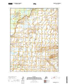
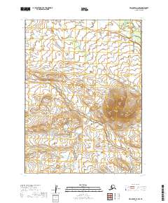
2019 Map of Dillingham C-3 NE
USGS Topo · Published 2019About this map
The Mulchatna River flows through the northern reaches of this remote landscape, a primary waterway in a region dominated by extensive wetland complexes and low-lying topography. The southern portion of the sheet is defined by the winding course of Nunachuak Cr, which drains a dense network of marshes and small ponds. This 2019 survey, produced by the U.S. Geological Survey, illustrates the complex hydrology typical of this part of the Dillingham Census Area. The lack of roads or established settlements emphasizes the wilderness character of the terrain, where drainage patterns and river corridors provide the only reliable points of orientation. The map clearly delineates the township and range boundaries, including t5s r45w and t6s r44w, which serve as the primary legal framework for this undeveloped territory.
Find a feature on this map
6 named features on this map. Tap any name to fly to it.
Don’t see what you’re looking for? This feature index may not catch every label — zoom into the map to look around manually.
Map Details
Editions of this 2019 Dillingham C-3 NE Map
This is the sole edition of this map. No revisions or reprints were ever made.
Other maps of this area

1951 · Dillingham
USGS Topo · 1:250,000

1954 · Dillingham
USGS Topo · 1:250,000

1954 · Dillingham C-3
USGS Topo · 1:63,360

1954 · Dillingham D-2
USGS Topo · 1:63,360

1954 · Dillingham D-3
USGS Topo · 1:63,360

1954 · Dillingham C-2
USGS Topo · 1:63,360
2019 · Dillingham C-3 NW
USGS Topo · 1:25,000
2019 · Dillingham C-3 SE
USGS Topo · 1:25,000
2019 · Dillingham D-3 SE
USGS Topo · 1:25,000
2019 · Dillingham C-2 NW
USGS Topo · 1:25,000