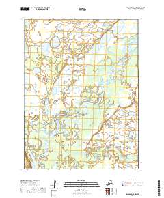
2019 Map of Dillingham C-3 NW
USGS Topo · Published 2019About this map
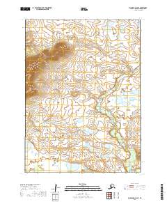
The Mulchatna River and the Nushagak River dominate this Alaskan landscape, tracing intricate, winding paths through the Dillingham Census Area. This 2019 survey captures the complex hydrology of the region, where major waterways and smaller tributaries like Nunachuak Cr and Cranberry Cr carve through the terrain. The absence of roads or established settlements emphasizes the undisturbed natural state of this wilderness within the Bristol Bay drainage basin.
Find a feature on this map
8 named features on this map. Tap any name to fly to it.
Don’t see what you’re looking for? This feature index may not catch every label — zoom into the map to look around manually.
Map Details
Editions of this 2019 Dillingham C-3 NW Map
This is the sole edition of this map. No revisions or reprints were ever made.
Other maps of this area

1951 · Dillingham
USGS Topo · 1:250,000

1954 · Dillingham
USGS Topo · 1:250,000

1954 · Dillingham C-3
USGS Topo · 1:63,360

1954 · Dillingham D-3
USGS Topo · 1:63,360

1954 · Dillingham D-4
USGS Topo · 1:63,360

1954 · Dillingham C-4
USGS Topo · 1:63,360
2019 · Dillingham C-3 SE
USGS Topo · 1:25,000
2019 · Dillingham D-3 SE
USGS Topo · 1:25,000
2019 · Dillingham C-3 NE
USGS Topo · 1:25,000
2019 · Dillingham D-4 SE
USGS Topo · 1:25,000