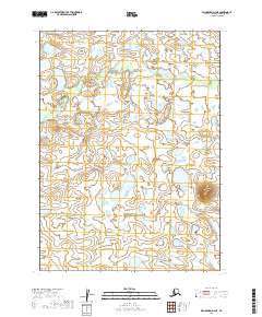
2019 Map of Dillingham D-4 NE
USGS Topo · Published 2019About this map
Harris Cr meanders across this landscape in the Dillingham Census Area, defining the primary drainage pattern for a region characterized by numerous small water bodies and varied wetland features. The terrain is marked by the Harris Creek basin, which cuts through the survey sections of T2S R47W and T2S R46W. While contemporary in its 2019 data, the map provides an essential reference for understanding the hydrological stability of this remote Alaskan environment over time.
Find a feature on this map
5 named features on this map. Tap any name to fly to it.
Don’t see what you’re looking for? This feature index may not catch every label — zoom into the map to look around manually.
Map Details
Editions of this 2019 Dillingham D-4 NE Map
This is the sole edition of this map. No revisions or reprints were ever made.
Other maps of this area

1950 · Taylor Mountains
USGS Topo · 1:250,000

1951 · Taylor Mountains
USGS Topo · 1:250,000

1951 · Dillingham
USGS Topo · 1:250,000

1954 · Taylor Mountains
USGS Topo · 1:250,000

1954 · Dillingham
USGS Topo · 1:250,000

1954 · Dillingham D-3
USGS Topo · 1:63,360

1954 · Taylor Mountains A-4
USGS Topo · 1:63,360

1954 · Dillingham D-4
USGS Topo · 1:63,360
1954 · Taylor Mountains A-3
USGS Topo · 1:63,360
2019 · Dillingham D-4 SW
USGS Topo · 1:25,000