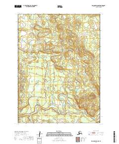
2019 Map of Dillingham D-5 NW
USGS Topo · Published 2019About this map
The Nuyakuk River meanders across the southern landscape of this remote Alaska interior quadrangle, serving as the dominant hydrologic feature. The river corridor is characterized by wide alluvial sweeps and marshy lowlands, typical of the river systems in the Dillingham Census Area. Feeding into this main artery is Arrow Creek (also labeled in part as Arrow Cr), which drains the northern elevations. The map reveals an area defined by its natural drainage patterns rather than human infrastructure, showing the terrain as it appeared during the 2019 U.S. Geological Survey update. This specific topography illustrates the complex relationship between the low-lying river plains and the subtle upland rises that define this portion of the Bristol Bay watershed.
Find a feature on this map
7 named features on this map. Tap any name to fly to it.
Don’t see what you’re looking for? This feature index may not catch every label — zoom into the map to look around manually.
Map Details
Editions of this 2019 Dillingham D-5 NW Map
This is the sole edition of this map. No revisions or reprints were ever made.
Other maps of this area

1950 · Taylor Mountains
USGS Topo · 1:250,000

1951 · Taylor Mountains
USGS Topo · 1:250,000

1951 · Dillingham
USGS Topo · 1:250,000

1954 · Taylor Mountains
USGS Topo · 1:250,000

1954 · Dillingham
USGS Topo · 1:250,000

1954 · Dillingham D-6
USGS Topo · 1:63,360
1954 · Dillingham D-5
USGS Topo · 1:63,360

1954 · Taylor Mountains A-5
USGS Topo · 1:63,360

1954 · Taylor Mountains A-6
USGS Topo · 1:63,360
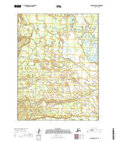
2019 · Dillingham D-5 SE
USGS Topo · 1:25,000