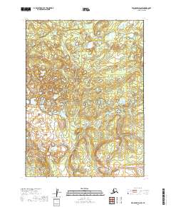
2019 Map of Dillingham D-6 SW
USGS Topo · Published 2019About this map
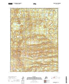
Glacial landforms and numerous unnamed water bodies dominate the terrain of the Dillingham Census Area in this 2019 survey. The landscape is defined by its complex hydrography and shifting contour lines, reflecting the remote interior of southwestern Alaska. The Public Land Survey System (PLSS) grid provides the primary framework for orientation, marking out sections within T3s R52w, T3s R51w, and T4s R52w. While the map remains sparse of named human settlements or road networks, it meticulously documents the natural drainage patterns and topographical shifts across townships like T4s R51w, T5s R53w, and T5s R52w. This detailed physical survey is essential for understanding the hydrological connectivity and the untrammeled character of the Dillingham region in the early twenty-first century.
Find a feature on this map
6 named features on this map. Tap any name to fly to it.
Don’t see what you’re looking for? This feature index may not catch every label — zoom into the map to look around manually.
Map Details
Editions of this 2019 Dillingham D-6 SW Map
This is the sole edition of this map. No revisions or reprints were ever made.
Other maps of this area

1951 · Dillingham
USGS Topo · 1:250,000

1954 · Dillingham
USGS Topo · 1:250,000

1954 · Dillingham C-6
USGS Topo · 1:63,360

1954 · Dillingham D-6
USGS Topo · 1:63,360

1954 · Dillingham D-7
USGS Topo · 1:63,360

1954 · Dillingham C-7
USGS Topo · 1:63,360
2019 · Dillingham D-6 NW
USGS Topo · 1:25,000
2019 · Dillingham D-6 NE
USGS Topo · 1:25,000
2019 · Dillingham D-7 NE
USGS Topo · 1:25,000
2019 · Dillingham D-6 SE
USGS Topo · 1:25,000