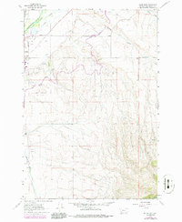
1962 Map of Dillon East
USGS Topo · Published 1986About this map
Dillon sits at the western edge of this landscape, serving as a hub for the agricultural and ranching operations of Beaverhead County. The Beaverhead River and Selway Slough define the low-lying valley floor, where an intricate network of irrigation projects like the Dillon Canal, East Bench Canal, and Stodden Ditch supports local cultivation. This infrastructure reflects the region's long-standing reliance on managed water to sustain valley life against the rising slopes to the east.
Find a feature on this map
23 named features on this map. Tap any name to fly to it.
Don’t see what you’re looking for? This feature index may not catch every label — zoom into the map to look around manually.
Map Details
Editions of this 1962 Dillon East Map
4 editions found
Other maps of this area

1893 · Dillon
USGS Topo · 1:250,000

1952 · Gallagher Mountain
USGS Topo · 1:24,000

1955 · Dillon
USGS Topo · 1:250,000

1957 · Dillon
USGS Topo · 1:250,000

1958 · Dillon
USGS Topo · 1:250,000

1961 · Glen SE
USGS Topo · 1:24,000

1961 · Christensen Ranch
USGS Topo · 1:24,000

1961 · Ashbough Canyon
USGS Topo · 1:24,000

1961 · Elk Gulch
USGS Topo · 1:24,000

1962 · Dillon
USGS Topo · 1:250,000