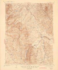
1934 Map of Dillon
USGS Topo · Published 1944About this map
The confluence of the Blue River and the Snake River anchors this landscape during a period when Dillon and Frisco served as vital transportation hubs. The map depicts a sophisticated mountain rail network, with the Colorado and Southern and the Denver and Rio Grande Western railroads converging at Dickey, which also features the Dickey Ranger Sta. This pre-reservoir era shows the original valley floor settlements before the landscape was altered by water management projects.
Find a feature on this map
69 named features on this map. Tap any name to fly to it.
Don’t see what you’re looking for? This feature index may not catch every label — zoom into the map to look around manually.
Map Details
Editions of this 1934 Dillon Map
3 editions found

Other maps of this area

1889 · Leadville
USGS Topo · 1:125,000

1891 · Leadville
USGS Topo · 1:125,000

1924 · Montezuma
USGS Topo · 1:62,500

1924 · Fraser
USGS Topo · 1:62,500

1926 · Fraser
USGS Topo · 1:62,500

1926 · Montezuma
USGS Topo · 1:62,500

1929 · Dillon
USGS Topo · 1:62,500

1933 · Mt. Powell
USGS Topo · 1:48,000

1933 · Montezuma
USGS Topo · 1:62,500

1933 · Ute Peak
USGS Topo · 1:62,500