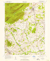
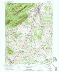
1952 Map of Dillsburg
USGS Topo · Published 1958About this map
Dillsburg and the surrounding townships of Carroll and Franklin define this landscape during the early 1950s. The northern reaches are dominated by the elevations of South Middleton and the Appalachian Trail, which winds along Long Mountain and past Stone Head. The map illustrates a rural society organized around crossroads communities and decentralized institutions, evidenced by the numerous small schools such as Blackberry School, Plainfield School, and Stony Brook School that dot the countryside. Along the waterways, Deardorffs Mill on Latimore Creek points to the area's agricultural and milling heritage. The presence of an abandoned racetrack near York Springs and the sprawling Camp Tuckahoe near Dogwood Run indicate shifts in local land use from traditional farming to recreation and youth organization sites during this era.
Find a feature on this map
62 named features on this map. Tap any name to fly to it.
Don’t see what you’re looking for? This feature index may not catch every label — zoom into the map to look around manually.
Map Details
Editions of this 1952 Dillsburg Map
5 editions found
Other maps of this area

1904 · Carlisle
USGS Topo · 1:62,500

1906 · New Cumberland
USGS Topo · 1:62,500

1908 · Gettysburg
USGS Topo · 1:62,500

1920 · Hanover
USGS Topo · 1:62,500

1922 · Hanover
USGS Topo · 1:62,500

1942 · Gettysburg
USGS Topo · 1:125,000

1943 · New Cumberland
USGS Topo · 1:62,500

1943 · Carlisle
USGS Topo · 1:62,500
1944 · Biglerville
USGS Topo · 1:31,680

1944 · Hampton
USGS Topo · 1:31,680